New satellite data used as an operational tool for mapping floods and improving climate adaptation
Data and information to improve flood protection and climate adaptation are in short supply. Satellite data has a significant potential to address this shortcoming by providing rapid, efficient and accurate mapping of surface water extent and flooded areas.
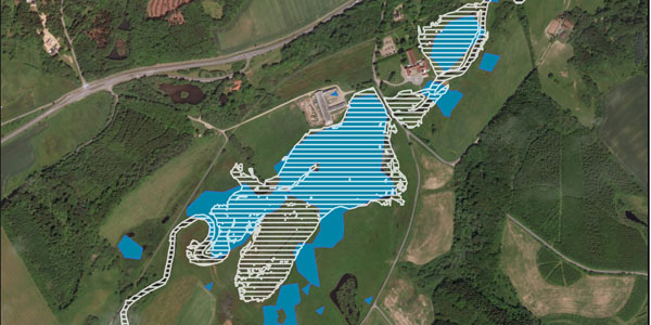
Satellite imagery can be an effective and timely source of data for mapping flooded areas. The increased availability of free satellite data in high spatial and temporal resolution provides new opportunities for operational use. Synthetic Aperture Radar (SAR) images from the Sentinel-1 satellites can provide maps of flooded areas with high resolution, regardless of weather, cloud cover or the time of day. This is particularly advantageous for flooding events in Denmark, where such events are often caused by heavy rain/cloudbursts and occur so quickly it is not possible to wait for clear sky images.
Improving forecasts of the risks from flooding
In a pilot project, DHI and the Danish Environmental Protection Agency (MST) are testing a new operational tool for predicting flows and water levels as well as mapping flooded areas along the Vejle River. Satellite-based mapping of historical flood events is being used to investigate and improve the calculations for determining which areas close to the river are at risk from flooding. The application of flood mapping in this pilot project for the Vejle River illustrates how satellite data can be used actively to enrich and support the development and improvement of flood forecasts. Together with model calculations, the satellite data can also be used to improve the quality of flood protection measures in the future.
Read more about the project here.
Read more