Our hydrographic monitoring stations in the Baltic and the North Sea collected unique data during the course of two record breaking storms that recently swept through Denmark. All four of our on-line Acoustic Doppler Current Profiler (ADCP) wave and current monitoring stations as well as the eight Triaxys and Datawell directional wave riders performed excellently through the storms.
The first storm named ‘Allan’ hit Denmark on 28 October 2013 with mean wind speeds reaching 40 m/s and gusts up to 54 m/s. During this storm, we measured a mean wave height of more than 6 m. A maximum wave height of up to 12 m was measured as well.
On 5-6 December 2013, the second storm – named Bodil – hit Denmark. Although it was weaker (with mean wind speeds reaching only 37 m/s and gusts of merely 44 m/s), it was longer lasting. Bodil also caused excessive flooding and damage in north eastern Denmark. During the storm, we measured a mean wave height of 8.0 m, while the maximum wave height exceeded 16 m in the North Sea at a position east of Helgoland. Meanwhile, in the Western Baltic near Bornholm, we measured waves higher than 4 m.
All our measuring buoys are still on-line. They survived these two events providing unique data series from the region which will be used in future estimates of design conditions for the region.
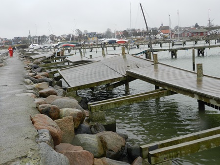
The photo shows what happens to a harbour that has not been designed according
to the standards. The damage to the harbour itself amounts to DKK 10 million,
excluding damage to the boats